Tanzania
Tanzania


Background
The United Republic of Tanzania (Swahili: Jamhuri ya Muungano wa Tanzania) is a country in East Africa bordered by Kenya and Uganda to the north, Rwanda, Burundi, and the Democratic Republic of the Congo to the west, and Zambia, Malawi, and Mozambique to the south. The country's eastern borders lie on the Indian Ocean.
Tanzania is a state composed of 26 regions (mikoa), including those of the autonomous region of Zanzibar. The head of state is President Jakaya Mrisho Kikwete, elected in 2010. Since 1996, the official capital of Tanzania has been Dodoma, where Parliament and some government offices are located. Between independence and 1996, the main coastal city of Dar es Salaam served as the country's political capital. Today, Dar es Salaam remains the principal commercial city of Tanzania and the de facto seat of most government institutions. It is the major seaport for the country and its landlocked neighbours.
The name Tanzania derives from the names of the two states Tanganyika and Zanzibar that united in 1964 to form the United Republic of Tanganyika and Zanzibar, which later the same year was renamed the United Republic of Tanzania.
Environmental and socioeconomic challenges

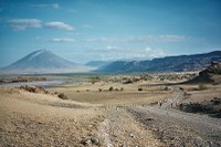
At 947,300 km², Tanzania is the world's 31st-largest country. Compared to other African countries, it is slightly smaller than Egypt and comparable in size to Nigeria. It lies mostly between latitudes 1° and 12°S, and longitudes 29° and 41°E. Tanzania is mountainous in the northeast, where Mount Kilimanjaro, Africa's highest peak, is situated. To the north and west are the Great Lakes of Lake Victoria (Africa's largest lake) and Lake Tanganyika (Africa's deepest lake, known for its unique species of fish). Central Tanzania comprises a large plateau, with plains and arable land. The eastern shore is hot and humid, with the island of Zanzibar lying just offshore.
Tanzania contains many large and ecologically significant wildlife parks, including the famous Ngorongoro Crater, Serengeti National Park[24] in the north, and Selous Game Reserve and Mikumi National Park in the south. Gombe National Park in the west is known as the site of Dr. Jane Goodall's studies of chimpanzee behaviour.
The government of Tanzania through its department of tourism has embarked on a campaign to promote the Kalambo water falls in the southwestern region of Rukwa as one of Tanzania's main tourist destinations. The Kalambo Falls are the second highest in Africa and are located near the southern tip of Lake Tanganyika. The Menai Bay Conservation Area is Zanzibar's largest marine protected area.
Climate of Tanzania
Tanzania has a tropical climate. In the highlands, temperatures range between (10 and 20 °C (50 and 68 °F)) during cold and hot seasons respectively. The rest of the country has temperatures rarely falling lower than 20 °C (68 °F). The hottest period extends between November and February (25–31 °C / 77–87.8 °F while the coldest period occurs between May and August (15–20 °C / 59–68 °F). Annual temperature is 32 °C (89.6 °F). The climate is cool in high mountainous regions.
Tanzania has two major rainfall regions. One is uni-modal (December–April) and the other is bi-modal (October–December and March–May). The former is experienced in southern, south-west, central and western parts of the country, and the latter is found to the north and northern coast.
In the bi-modal regime the March–May rains are referred to as the long rains or Masika, whereas the October–December rains are generally known as short rains or Vuli. As this country lies in equator here the climate is hot and humid. The easterlies winds cause rainfall in the eastern coastal region.
Environment
Tanzania has considerable wildlife habitat, including much of the Serengeti plain, where the white-bearded wildebeest (Connochaetes taurinus mearnsi) and other bovids participate in a large-scale annual migration. Up to 250,000 wildebeest perish each year in the long and arduous movement to find forage in the dry season. Tanzania is also home to 130 amphibian and over 275 reptile species, many of them strictly endemic and included in the IUCN Red Lists of different countries.
Tanzania has developed a Biodiversity Action Plan to address species conservation. A recently discovered species of elephant shrew called Grey-faced Sengi was filmed first time in 2005, and it was known to live in just two forests in the Udzungwa Mountains. In 2008, it was listed as "vulnerable" on the 2008 Red List of Threatened Species. Lake Natron is northern Tanzania is the largest breeding site for the threatened Lesser Flamingo, a huge community of which nest in the salt marshes of the lake. Areas of East African mangroves on the coast are also important habitats.
Links
http://en.wikipedia.org/wiki/Tanzania
PRODAP National Coordination Unit
UNDP/GEF Project Management Unit
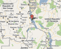
The Tanzanian shoreline occupies 41% of Lake Tanganyika. It encompasses vital areas for biodiversity conservation, including the Malagarasi River basin, Gombe Stream and Mahale Mountains National Parks. The largest settlement on the Tanzanian shore is the Kigoma/Ujiji Municipality.
Human growth rates in the region are high compared to most areas in Tanzania, partly as a result of refugee influxes from Burundi and DR Congo. The current population of the Kigoma region is over 1.6 million, with an average growth rate of 5.1%. Agricultural encroachment, clearing of bush to eradicate tsetse flies, village settlements, bushfires, overgrazing, and high wood demands have caused excessive deforestation rates in the region, with an average of 0.90% per year[1].
Pollution and eutrophication from solid waste and untreated wastewater in the Kigoma/Ujiji Municipality is having an increasingly detrimental effect on biodiversity. Kigoma presently lacks a water treatment plant as well as capacity to adequately process solid waste.
The UNDP/GEF Project on Lake Tanganyika aims to pilot innovative strategies for sustainable catchment management in the Kigoma and neighbouring Rukwa region, and strengthen capacity for pollution control in the Kigoma/Ujiji Municipality.
[1] Tanzania national average deforestation rate per year is 0.45%.
Document Actions


