DRC
Democratic Republic of Congo

Background
The Democratic Republic of the Congo (French: République démocratique du Congo) is a state located in Central Africa. It is the second largest country in Africa by area and the eleventh largest in the world. With a population of over 71 million, the Democratic Republic of the Congo is the eighteenth most populous nation in the world, and the fourth most populous nation in Africa, as well as the most populous officially Francophone country.
The Democratic Republic of the Congo is often referred to as Congo. However, in order to distinguish it from the neighbouring Republic of the Congo to the west, the Democratic Republic of the Congo is sometimes referred to as DR Congo, DRC, or RDC (from its French abbreviation), or is called Congo-Kinshasa after the capital of Kinshasa (in contrast to Congo-Brazzaville for its neighbour). It also borders the Central African Republic and South Sudan to the north; Uganda, Rwanda, and Burundi in the east; Zambia and Angola to the south; the Atlantic Ocean to the west; and is separated from Tanzania by Lake Tanganyika in the east. The country has access to the ocean through a 40-kilometre (25 mi) stretch of Atlantic coastline at Muanda and the roughly 9 km wide mouth of the Congo River which opens into the Gulf of Guinea.
The Second Congo War, beginning in 1998, devastated the country, involved seven foreign armies and is sometimes referred to as the "African World War". Despite the signing of peace accords in 2003, fighting continues in the east of the country. In eastern Congo, the prevalence of rape and other sexual violence is described as the worst in the world.The war is the world's deadliest conflict since World War II, killing 5.4 million people since 1998. The vast majority died from malaria, diarrhea, pneumonia and malnutrition.
The Democratic Republic of the Congo was formerly, in chronological order, the Congo Free State, Belgian Congo, Congo-Léopoldville, Congo-Kinshasa, and Zaire (Zaïre in French). Though it is located in the Central African UN subregion, the nation is also economically and regionally affiliated with Southern Africa as a member of the Southern African Development Community (SADC).
Environmental and geographic challenges
The Democratic Republic of Congo is situated at the heart of sub-Saharan Africa and is bounded by (clockwise from the southwest) Angola, the South Atlantic Ocean, the Republic of Congo, the Central African Republic, South Sudan, Uganda, Rwanda, Burundi, Tanzania across Lake Tanganyika, and Zambia. The country lies between latitudes 6°N and 14°S, and longitudes 12° and 32°E. It straddles the Equator, with one-third to the North and two-thirds to the South. The size of Congo, 2,345,408 square kilometres (905,567 sq mi), is slightly greater than the combined areas of Spain, France, Germany, Sweden, and Norway.
As a result of its equatorial location, the Congo experiences high precipitation and has the highest frequency of thunderstorms in the world. The annual rainfall can total upwards of 80 inches (2,000 mm) in some places, and the area sustains the Congo Rainforest, the second largest rain forest in the world (after that of the Amazon). This massive expanse of lush jungle covers most of the vast, low-lying central basin of the river, which slopes toward the Atlantic Ocean in the west. This area is surrounded by plateaus merging into savannas in the south and southwest, by mountainous terraces in the west, and dense grasslands extending beyond the Congo River in the north. High, glaciated mountains are found in the extreme eastern region.
The tropical climate has also produced the Congo River system which dominates the region topographically along with the rainforest it flows through, though they are not mutually exclusive. The name for the Congo state is derived in part from the river. The river basin (meaning the Congo River and all of its myriad tributaries) occupies nearly the entire country and an area of nearly 1,000,000 km2 (390,000 sq mi). The river and its tributaries (major offshoots include the Kasai, Sangha, Ubangi, Aruwimi, and Lulonga) form the backbone of Congolese economics and transportation. They have a dramatic impact on the daily lives of the people.
The sources of the Congo are in the highlands and mountains of the East African Rift, as well as Lake Tanganyika and Lake Mweru. The river flows generally west from Kisangani just below Boyoma Falls, then gradually bends southwest, passing by Mbandaka, joining with the Ubangi River, and running into the Pool Malebo (Stanley Pool). Kinshasa and Brazzaville are on opposite sides of the river at the Pool.
Then the river narrows and falls through a number of cataracts in deep canyons (collectively known as the Livingstone Falls), and then running past Boma into the Atlantic Ocean. The river also has the second-largest flow and the second-largest watershed of any river in the world (trailing the Amazon in both respects). The river and a 45 km wide strip of land on its north bank provide the country's only outlet to the Atlantic.
The previously mentioned Great Rift Valley, in particular the Eastern Rift, plays a key role in shaping the Congo's geography. Not only is the northeastern section of the country much more mountainous, but due to the rift's tectonic activities, this area also experiences volcanic activity, occasionally with loss of life. The geologic activity in this area also created the famous African Great Lakes, three of which lie on the Congo's eastern frontier: Lake Albert (known previously as Lake Mobutu), Lake Edward, and Lake Tanganyika.
The Rift Valley has exposed an enormous amount of mineral wealth throughout the south and east of the Congo, making it accessible to mining. Cobalt, copper, cadmium, industrial and gem-quality diamonds, gold, silver, zinc, manganese, tin, germanium, uranium, radium, bauxite, iron ore, and coal are all found in plentiful supply, especially in the Congo's southeastern Katanga region.
On 17 January 2002 Mount Nyiragongo erupted in Congo, with the lava running out at 40 mph (64 km/h) and 50 yards (46 m) wide. One of the three streams of extremely fluid lava flowed through the nearby city of Goma, killing 45 and leaving 120,000 homeless. Four hundred thousand people were evacuated from the city during the eruption. The lava poisoned the water of Lake Kivu, killing fish. Only two planes left the local airport because of the possibility of the explosion of stored petrol. The lava passed the airport but ruined the runway, entrapping several airplanes. Six months after the 2002 eruption, nearby Mount Nyamulagira also erupted. Mount Nyamulagira also erupted in 2006 and again in January 2010. Both of these active volcanos are located within the boundaries of Virunga National Park.
World Wildlife Fund ecoregions located in the Congo include:
- Central Congolian lowland forests – home to the rare bonobo primate
- The Eastern Congolian swamp forests along the Congo River
- The Northeastern Congolian lowland forests, with one of the richest concentrations of primates in the world
- Southern Congolian forest-savanna mosaic
- A large section of the Central Zambezian Miombo woodlands
- The Albertine Rift montane forests region of high forest runs along the eastern borders of the country.
World Heritage Sites located in Democratic Republic of Congo are: Virunga National Park (1979), Garamba National Park (1980), Kahuzi-Biega National Park (1980), Salonga National Park (1984) and Okapi Wildlife Reserve (1996).
Links
http://en.wikipedia.org/wiki/Democratic_Republic_of_the_Congo
PRODAP National Coordination Unit
PRODAP is one of the components of the Lake Tanganyika Regional Integrated Development and Management Programme (LTRIDMP), which includes priority interventions identified in the Strategic Action Programme and the Framework Fisheries Management Plan for the lake. The LTRIDMP is based on the needs expressed by the riparian communities and is consistent with the objectives of the Poverty Reduction Strategy Papers of the four riparian countries. Supporting partners for the LTRIDMP include the African Development Bank, the United Nations Development Programme, the Global Environment Facility, the Nordic Development Fund, FAO, the World Conservation Union and the United Nations Environment Programme.
UNDP/GEF Project Management Unit (PMU)
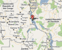
Uvira is situated in the Democratic Republic of Congo, South Kivu Province. Socio-economic development in the region has been greatly disrupted due to prolonged and tragic ethnic conflicts. High densities of people have concentrated in the Uvira region during conflict periods. In 2008, the region counted 452,360 inhabitants, with an average density of 110 people per km2.
Poverty is rampant, and many people have sought to maximise short-term benefits of natural resource use as a survival strategy. Hillsides in the region are very steep, and with increasing human population densities they have become heavily deforested with extensive soil erosion as a result. Major flash floods have carved steep channels through the Uvira catchment area, and sedimentation has had significant negative effects on aquatic biodiversity.
The UNDP/GEF Project on Lake Tanganyika works together with the Worldwide Fund for Nature (WWF) to take a holistic approach to water resource management in the Uvira catchment area, embracing wide stakeholder participation.
PMU DRC in action
The DRC Component of the UNDP/GEF Project on Lake Tanganyika focuses on strengthening government and local institutions with capacity to improve catchment management, and offering tools to farming communities in the region in order to adopt sustainable and restorative forestry and woodlot practices. The project furthermore promotes the uptake of fuel-efficient stoves and alternative energy sources.
The Project Management Unit (PMU) was established in Uvira in September 2010, and substantial progress has been made since then. Three sub-catchments were selected and characterised with support from the World Agroforestry Centre (ICRAF). Campaigns were conducted to raise local awareness about deforestation and forest management issues in relation to local livelihoods and conservation of biodiversity in Lake Tanganyika. Training was conducted on best agricultural and agroforestry practices and soil management techniques, as well as on bushfire prevention approaches.
So far, over 25,000 agroforestry trees have been planted on selected sites, covering nearly 200 ha. In addition 32 ha of trees were planted in old forest management areas. The second planting season was officially opened on 17 September 2011, and met with great enthusiasm from the local community. To ensure sustainability, the PMU is developing sub-catchment management plans and monitoring systems together with the government institute Centre de Recherche Hydrobiologique.
Document Actions


